
Small drones or UAVs (unmanned aerial vehicles) are becoming increasingly used in the service and commercial industry. The potentials of aerial photography are endless. With ever more sophisticated systems using complex software, drones are capable of performing a wide range of job-specific tasks. Not only do drones provide accurate high definition imagery, but also provide monitoring, measuring and detailed evaluations and calculations.
It’s hardly surprising that providing drone services can be a highly lucrative investment.
The Commercial Uses of Drones
Various industry sectors outsource private companies for different drone-powered solutions, as drones provide a clarity from above that simply cannot be matched by other means.
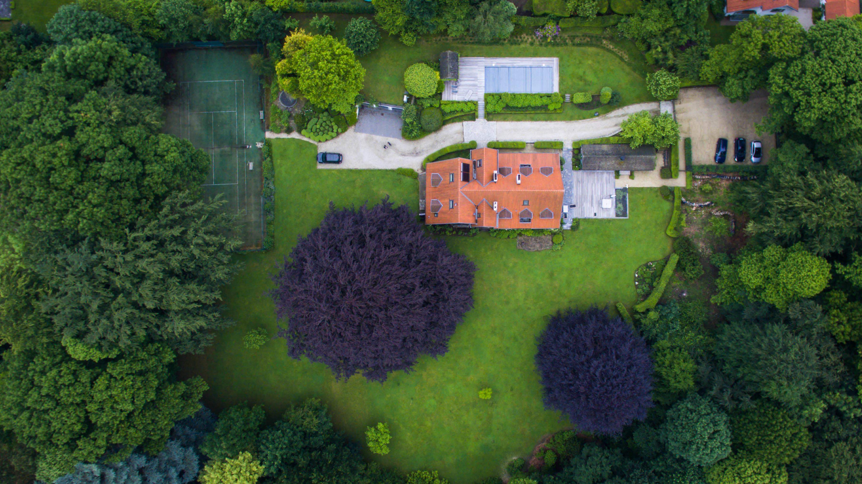
The Property Industry and Hotels & Resorts
Aerial views of estates and properties are beneficial for generating interest and landing a sale. This is especially true for larger luxury properties. Drones make an excellent marketing tool, producing high quality, attractive images and footage.
News and the Media
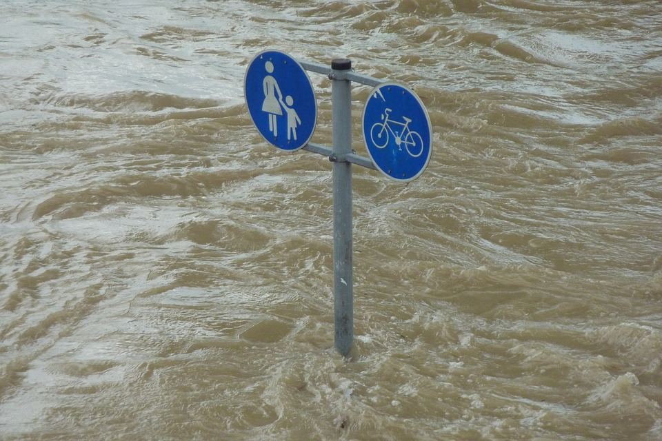
News helicopters are expensive to run and their use is limited. Filming from the sky using a drone however, introduces new dimensions when it comes to reporting. It provides a birds eye view and high quality footage of numerous events that are difficult to cover on foot such as natural disasters.
Events
Aerial coverage of large events or “crowd shots” can provide useful head counts at festivals and such like. Sporting events, snow sports and racing in particular, are also becoming increasingly popular to film.
Corporate Show-Reels and Promotional Work
For larger corporations, a show-reel is an excellent form of promotional material which drones can make more attractive.
Weddings and Special Occasions
This is another especially lucrative industry, where individuals are willing to shell out for images of the best quality available to remember their special day. Many party organisers will also hire drones to provide footage of the event.
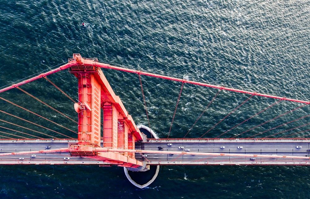
Infrastructure
Drones can provide detailed aerial inspections of roads, bridges, railway tracks, power lines, wind farms and other areas of infrastructure. This is very helpful to local authorities.
Mapping and Surveying
The use of HD video and imaging, light detection and ranging (LIDAR) enables drones to provide highly accurate 3D images quickly and effectively, that are also easy to update. Drones are becoming increasingly used in the fields of geology and archaeology. You can use drones to create 3d images such as the one below:
3D Drone Photography
Drone Photography With Oil and Gas Industry
There are many vital inspections that need to be carried out in this industry and are simply too dangerous or difficult to be accessed by personnel. This is where drones provide a quick and safe solution for a range of services within this industry.
- Off-shore platforms – drones can fly within a few metres of a platform producing detailed aerial images.
- Pipeline inspection – miles of pipeline can be inspected in a limited amount of time.
- Flarestack inspections – eliminates the safety risk involved in physically climbing up a flarestack.
- Gas emissions monitoring – drones with optical sensors are able to safely monitor gas emissions.
- Oil spill inspections – data collected by drones is used to assess environmental damage and make predictions as to how far and quickly damage from spills will spread.
- Tailings Ponds inspections – a slow and hazardous job to carry out manually, drones are much safer and quicker.
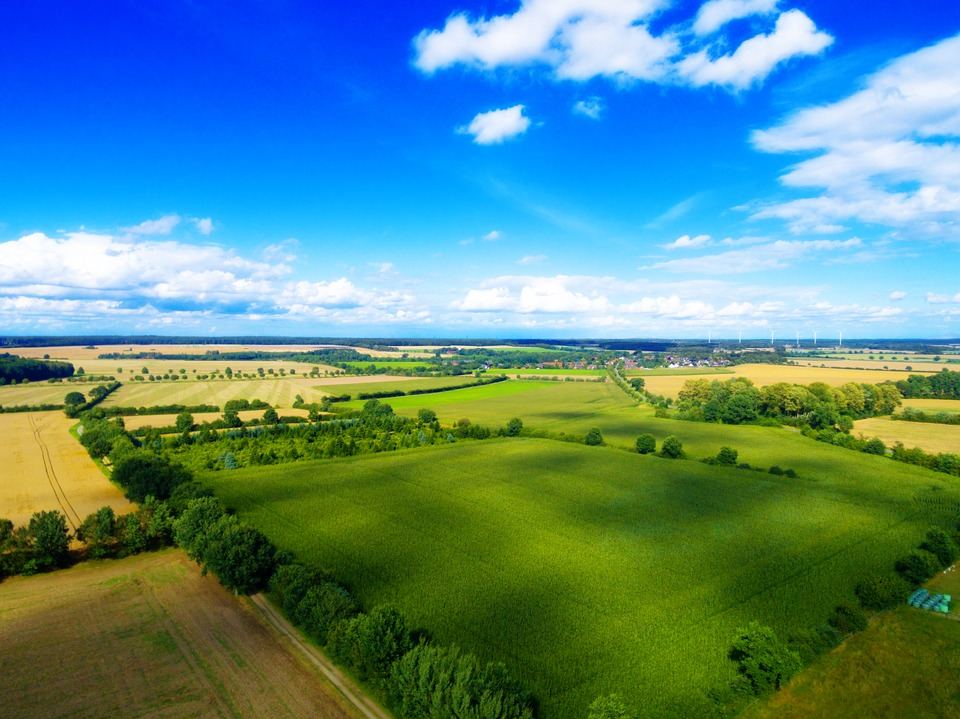
Agriculture
The use of drones is becoming progressively more common in this industry, not only for mapping and surveying, but to determine the state of crops. Farmers are able to see if they are thriving or not and even measure moisture levels in order to determine an appropriate plan of action.
Construction
Drones are extremely useful in construction where the inspection of the tops of tall buildings is needed. Drones can produce aerial footage and eliminate the need for the use of scaffolding for this purpose – this enables a straightforward progress reporting system that can be used for multiple sites.
Mining
Advantageous in the mining industry – measuring rock stockpiles is now much quicker and easier with the use of drones. This was previously a manual job involving employees physically walking around and measuring using a GPS. Drones can produce detailed 3D images with comprehensive information providing accurate measurements.
How to Become a UAV Pilot
In order to fly a drone/UAV, permission from the Civil Aviation Authority (CAA) is needed. The CAA oversees and regulates all aspects of civil aviation in the UK. Drone pilots need to be educated on all aspects of aviation law and safe operation of a UAV. You will need to undertake a flight test amongst other things. For further reading on the requirements see:
Author
Richard is lead photographer and media specialist at Skycast Media (http://www.skycastmedia.co.uk). He has a passion for the end result which, at the end of the day, despite all the hype and publicity with drones, is really what aerial filming & photography is all about.


Leave a Reply