
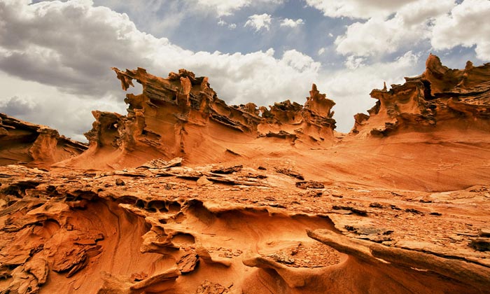
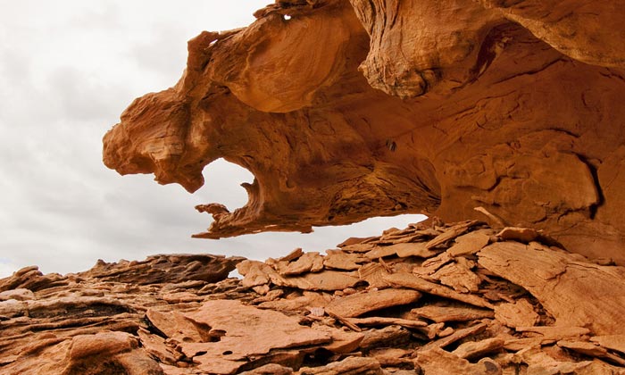
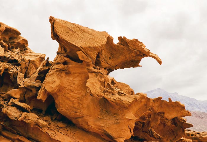
A strange red sandstone landscape, called Little Finland, is fourteen miles east of Nevada’s Valley of Fire State Park in a remote part of the Nevada desert.
Four-wheel-drive is recommended for Little Finland Nevada, but a high-clearance vehicle will take you there. If you love photographing the deserts of the Southwest, add this place to your list.
Little Finland is on BLM (Bureau of Land Management) property. There are no entry fees and you do not need a permit for the area or to camp at the end of the road. Purchase the USGS 7.5 minute topo map called Devil’s Throat, Nev. Pack a compass and a GPS receiver if you have one. Pack lenses from 10 mm wide-angle to a 300 mm telephoto.
Preparing Your Trip To Little Finland Nevada
Bring a friend along with a second high-clearance vehicle. Four-wheel-drive, all-terrain tires, full gas tanks, and radios for communication between vehicles are also recommended. Pack a towrope and a lunch. Do not attempt this all-day exploration on a rainy or windy day. Avoid high summer temperatures. Late autumn or early spring has the best weather.
Eighty miles northeast of Las Vegas on Interstate 15, take the Riverside/Bunkerville Exit. Stop at the bottom of the hill and reset your trip odometer to zero. Drive south three miles to a bridge over the Virgin River. On the south side of the river, turn right onto the first paved side road you come to.
This is called the Gold Butte Road. The next twenty-four miles are paved. Stay on the pavement. When you reach the center of large red rock formations called Whitney Pockets, the pavement ends. Your odometer should read 23.7 miles.
At the end of the pavement, continue driving straight ahead as you leave the asphalt. Follow the well-graded, unpaved Gold Butte Road that continues straight on well-graded gravel for 6.9 miles to a large BLM sign pointing west to Devils Throat and Red Bluff Spring. At the junction, your odometer should read 30.6 miles. N 36˚25’58” W 114˚08’38”
Turn right at this junction and drive a quarter-mile to another fork where you’ll turn right again. This road is a bit rough in spots with a few rocks to avoid and a few sandy spots that do not require a four-wheel-drive vehicle. Four miles beyond the spot where you left the Gold Butte Road, this route drops into Mud Wash. Turn left and drive down a wide gravel streambed that passes between red canyon walls through an area called “The Narrows.” This part of the route is easy to follow. Just stay in the wash.
Follow the most-heavily traveled route down Mud Wash. A half-mile beyond the narrows is a large panel of petroglyphs on the right. Two miles beyond the petroglyphs is a dark wooden corral, made of old railroad ties, on the right side of the wash. It sits down in the wash, next to the “road.”
Keep driving down Mud Wash for another two miles beyond the corral and you will come to the opening of another wash, entering Mud Wash, on your right.
N 36˚27’49” W 114˚14’02”
Turn right, and drive up this other wash that almost reverses your direction for one mile. You’ll see two more trail markers. One to the left is marked “Dead End” and the other is marked “Designated Route.” Follow the tracks to the right and, in a couple hundred yards, you’ll reach a wide spot in the wash where all the tire tracks loop around and head back down the same wash. Stop there.
N 36˚27’22” W 114˚13’15”
After parking and gathering up all your camera gear, you can make the final, half-mile cross-country walk from the new parking area by heading east toward the highest point above the red hills in the distance.
If you are not sure which direction to walk, follow the old road along the bottom of the wash and you will soon walk between several vehicle barrier posts. In ten more minutes, you’ll reach a wide, flat parking area at the base of forty-foot high red rock cliffs above five palm trees.
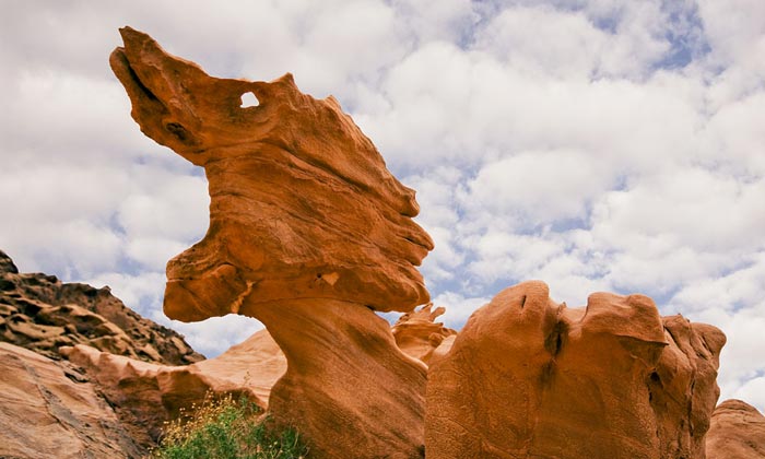
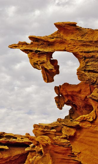
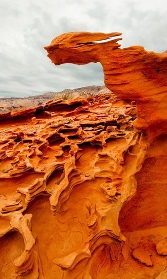
At the near end of the cliff is a steep jeep trail that climbs to the rim of the cliffs near an easily climbed “gate” in a barbed wire fence. Once over the wire, it’s a hundred-foot walk to the edge of the strangest examples of erosion you will ever discover.
N 36˚27’09” W 114˚12’53”
Be sure to include this part of the Nevada desert in your next trip to the southwest and see what creatures you can capture with your camera.
Little Finland Nevada by Robert Hitchman, Photograph America
Leave a Reply